Bandung, the capital of West Java province, is the fourth largest city in Indonesia located about 180 km (112 miles) southeast of Jakarta. With over 2.9 million population in 2007 and over 7.2 million people on the greater Bandung regency and metropolitan area, is the one densely populated city in Asia. Bandung is rated the fastest-growing major city / urban region in Indonesia. Bandung elevation is 768 m above sea level and is surrounded by up to 2400 m high Late Tertiary and Quartemary volcanic terrain. The 400 km2 flat of central Bandung plain is situated in the middle of 2,340.88 km2 wide of the Bandung Basin; the Basin comprises Bandung, the Cimahi city, part of Bandung Regency, part of West Bandung Regency, and part of Sumedang Regency. The basin's main river is the Citarum; one of its branches, the Cikapundung, divides Bandung from north to south before it merges Citarum again in Dayeuhkolot. The Bandung Basin is an important source of water for drinking water, irrigation and fisheries, and its 6,147 million m2 of groundwater is a major reservoir for the Bandung city.
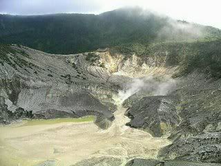
The northern part of the Bandung city is hillier than the rest; the distinguished truncated flat-peak shape of the Tangkuban Perahu volcano can be seen from the city to the north. Long-term volcanic activity has created fertile andisol soil in the north, suitable fo intensive rice, fruit, tea, tobacco and coffee plantations. In the south and east, alluvial soils deposited by the Cikapundung river are mostly found.
The climate in Bandung is cooler than most Indonesian cities and can be classified as humid; the average temperature in Bandung is 23.6°C (74.5OF) throughout the year.
No comments:
Post a Comment